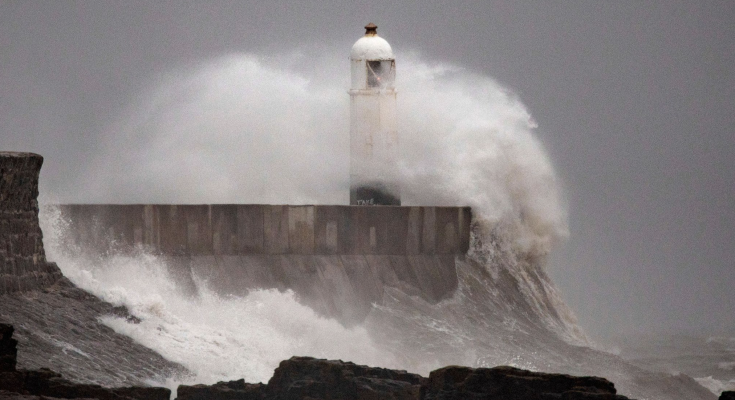
Storm Bert will finally clear the UK – but how long settled conditions will last is uncertain, according to Met Office forecasts.
Storm Bert continues to cause chaos in the UK, but just how long is heavy rain and wind expected to batter the country?
The Met Office says Storm Bert will start to “slowly pull away” from the UK on Monday, meaning an unsettled start to the day.
A yellow weather warning remains in place for northern parts of Scotland.
It warns of heavy downpours, especially over higher ground, where accumulations of 50-70mm are expected. The warning is in place until midnight.
Storm Bert latest: Follow live updates
In central Scotland, wind speeds of 50-60mph are likely, and gusts up to 70mph could be felt near the coast and on exposed bridges.
Met Office chief meteorologist Andy Page said that while the risk of snowfall had now diminished, rainfall would “affect much of the UK”.
Frequent showers are expected in Northern Ireland, northern England, Wales and the West Country, with the heaviest expected in southwestern parts of England and South Wales.
Mr Page said weather warnings “could still be amended” and possibly at short notice, and urged people to “keep up to date with the very latest forecast”.
Sky News meteorologist Christopher England warns there could be a risk of hail and thunder in northern Scotland, at the start of the week.
As of Monday morning, there were hundreds of flood warnings and alerts in place. Three of those – two in Wales and one in England – were “severe warnings”.
A further 160 flood warnings and more than 200 flood alerts were issued by the Environment Agency in England, and eight flood warnings and 23 flood alerts in place in Wales at the time of writing.
Bert to clear UK by Tuesday
By Tuesday, Storm Bert will finally clear the UK, the Met Office said, bringing with it “quieter weather for many”.
However, parts of the country may not be without rain or wind for long, as the forecaster says strong gusts and rainfall could start again on Tuesday night and into Wednesday.
Check the forecast in your area
“How long the more settled conditions last is uncertain, with rain probably returning to westernmost areas at least by the end of the week,” the Met Office website says.
Chris England adds: “Wednesday will bring strong winds and a spell of heavy rain across the south, while the north looks mostly fine after a frosty and foggy start in places.
“Thursday looks cool again, but mostly fine. Friday will be milder, with outbreaks of rain likely over Ireland, Northern Ireland and north-west Scotland.”
He says going into the weekend, Saturday “looks cloudy and breezy in the north and west, with a little rain possible at times”.
When could the next named storm be?
Storm Bert was the second named storm of the season after Storm Ashley brought similar wet and windy conditions towards the end of October.
Although it cannot be known for sure when the next storm will be, the Met Office already knows it will be referred to as Storm Conall. The forecaster names storms in alphabetical order.
It says it only names a storm when it has the “potential to cause disruption or damage which could result in an amber or red warning” and according to its long range forecast, this could be as soon as next month.
It says that between 9 and 23 December, “there are signs” there will be wetter and windier interludes with a risk of snow, adding: “These conditions look more likely to dominate towards the middle of December.”
Whether this will be strong enough for a storm to be named remains unknown.


