Red flag warnings for U.S. states have been issued, outlining the exact locations, times the warnings shall remain in effect, and precautions. There are also reports of severe weather threats increasing.
The National Weather Service’s official bulletin outlines the full scope of today’s (February 28, 2025) Red Flag Warnings across six states in the U.S. One state is Nebraska, where virtually the entire eastern portion of the state falls under the alert.
In counties including Knox, Wayne, Dodge, Lancaster, and Sarpy, conditions are expected to become dangerous from 10 a.m. until 8 p.m. Northwesterly winds are expected to reach speeds of 20 to 35 miles per hour, occasionally gusting up to 45 miles per hour.
Similar warnings apply to Nebraska’s expansive Sandhills region, the Niobrara Valley, and areas such as the Eastern Panhandle and Frenchman Basin, all of which are also under the warning until early evening.
In these western and central zones, gusts could peak at 50 miles per hour, compounding the risk of fires racing across the dry landscape. Iowa faces its own heightened risk across both northern and central portions of the state, with two separate warnings taking effect.
In northern counties like Emmet, Kossuth, and Winnebago, conditions are expected to deteriorate by noon and remain dangerous through 6 p.m. In central and southern Iowa, including areas such as Polk, Jasper, and Marion counties, the same window of risk applies.
Winds across the state will roar between 25 and 35 miles per hour, and gusts could surge as high as 55 miles per hour, particularly in the afternoon. In addition, southwestern counties like Pottawattamie, Mills, and Montgomery are also covered under a similar alert. Those warnings run from 10 a.m. until 6 p.m.
In South Dakota, multiple regions are under red flag warnings today, spanning from the Missouri River Valley to the eastern and south-central corners of the state.
In counties including Gregory, Charles Mix, and Yankton, the warning is active between 10 a.m. and 6 p.m. Meanwhile, in the Bennett County area and as far as Mellette and Todd counties, the warning period shifts slightly earlier, beginning at 9 a.m. Mountain Time and concluding by 5 p.m.
Gusty winds topping 50 miles per hour are expected in some locations, with conditions growing particularly dangerous as temperatures push into the upper 50s and low 60s.
Illinois’ warnings focus heavily on the eastern part of the state, with counties such as Clinton, Jackson, and Dubuque included in the alert. Beginning at noon and lasting until 6 p.m., the concern centers on rapidly increasing winds, which could gust up to 50 miles per hour. Humidity levels could drop as low as 35 percent.
Missouri is also bracing for the threat, with counties across northern, western, and central Missouri—including Platte, Buchanan, and Boone—all under the warning from 10 a.m. until 8 p.m.
Kansas rounds out the list of affected states, with fire weather warnings stretching across north-central, northeast, and east-central portions of the state. Counties such as Republic, Riley, and Shawnee fall under the advisory, which spans from 10 a.m. to 8 p.m.
The state faces an added challenge, as winds may shift slightly throughout the day, beginning from the west before turning northwest by afternoon. Gusts could approach 35 miles per hour, adding further volatility to already dry conditions.
Additionally, parts of southeastern Kansas, including Bourbon and Cherokee counties, are also under warning. They match the 10 a.m. to 8 p.m. timeframe and reflect similar threats posed by powerful winds and exceptionally dry air.
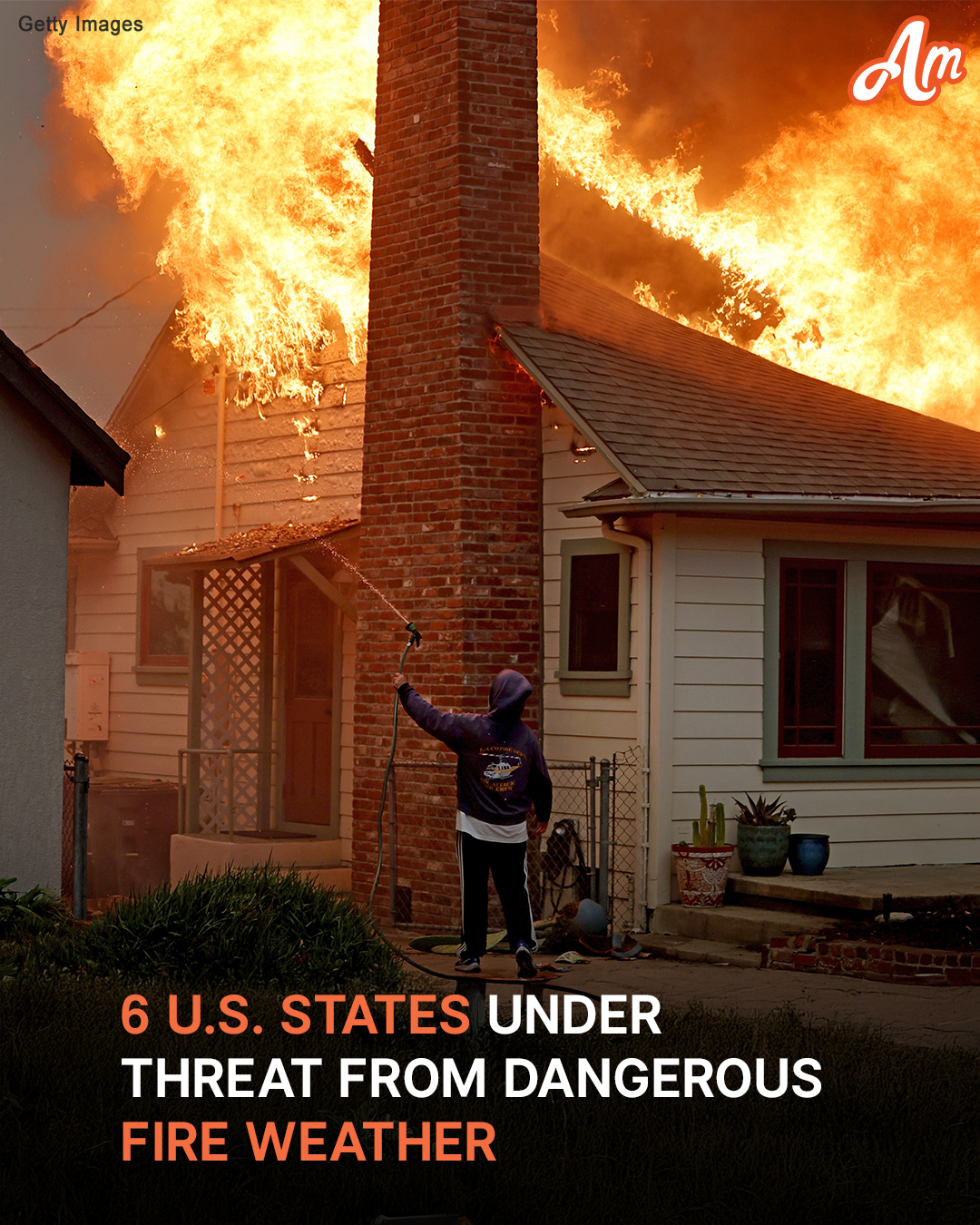
The National Weather Service (NWS) warns that any fires that develop will likely spread quickly, making them difficult to control or extinguish. As a result, residents are strongly advised to avoid any outdoor burning.
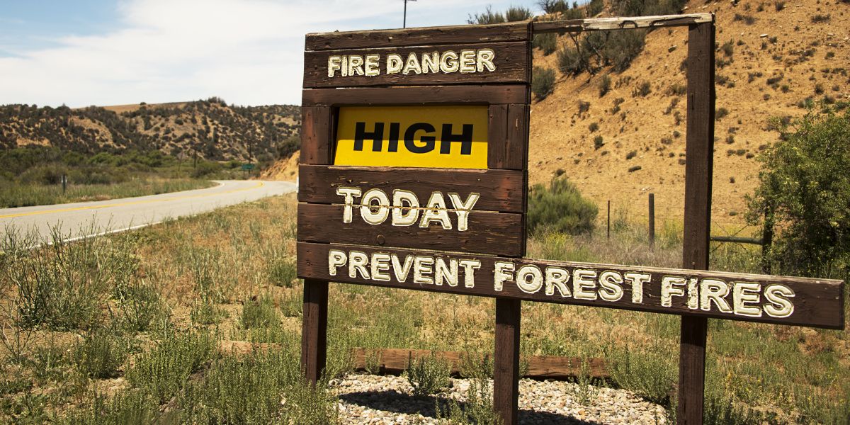
As described by the NWS, a Red Flag Warning signals a dangerous alignment of weather conditions known to significantly increase the risk of wildfires. These warnings are issued when a combination of warm temperatures, extremely low humidity levels, and powerful winds creates an environment where fires can ignite easily and spread rapidly.
In light of these heightened dangers, the organization strongly urges residents in affected areas to take safety measures to minimize the chance of accidental fires.
For those permitted to burn materials outdoors, safety guidelines require that burn barrels be fitted with sturdy metal covers, ensuring any openings are no wider than three-quarters of an inch.
Additionally, the agency stresses the importance of responsible behavior when discarding smoking materials. Cigarettes, matches, and similar items should never be tossed from moving vehicles, as they can easily land in dry roadside grass and trigger a wildfire.

The Hughes Fire running up a mountain side of Lake Hughes in California on January 22, 2025. | Source: Getty Images
Any outdoor fires that are started should be fully extinguished. Simply covering the flames is not enough; fires must be thoroughly soaked with water, stirred to ensure every ember is out, and confirmed to be cool to the touch.
Charcoal from grills should also be doused with water until cold, rather than being left smoldering on the ground.
Above all, the NWS emphasizes that no fire should ever be left unattended. Unmonitored flames can quickly reignite and send sparks drifting into nearby dry grass, where a small fire can become a fast-moving threat in minutes.
By following these safety recommendations, residents can play a crucial role in reducing the risk of devastating wildfires during Red Flag conditions.
In addition to the warnings already issued by the National Weather Service, meteorologists are closely monitoring a developing severe weather threat expected to unfold across the southern, central, and eastern United States next week.
According to a report from AccuWeather, the first significant outbreak of severe weather for March is forecast to begin on Tuesday. Conditions are expected to intensify over parts of the southern Plains and lower Mississippi Valley before spreading eastward toward the Appalachians and the southeastern coastline by Wednesday.
The threat includes the potential for damaging thunderstorms and even tornadoes. This upcoming system traces its origins to a powerful storm currently moving over the northern Pacific Ocean, which is expected to sweep into the northwestern U.S. over the weekend before diving southeastward across the Rockies.
Once the system reaches the southern states, it is likely to tap into moisture from the Gulf of Mexico, colliding with warming air and a strong jet stream to create ideal conditions for severe weather.
AccuWeather meteorologists caution that this two-day event could produce more widespread severe weather incidents than a similar outbreak seen in mid-February. This incident resulted in hundreds of storm reports and several tornadoes.
“This event, spanning two days, is likely to bring much more severe weather incidents when compared to a couple of weeks ago in a similar area,” AccuWeather Expert Meteorologist Guy Pearson said.
On Tuesday, the highest risk zone stretches across northeastern Texas, northern Louisiana, southern Arkansas, and central Mississippi. This is where damaging straight-line winds between 65 and 75 miles per hour are expected, along with the possibility of isolated tornadoes.
By Wednesday, the threat expands north and east, potentially impacting areas from Ohio to Florida and Virginia as the storm tracks toward the Midwest.
“As we see it now, thunderstorms are likely to erupt rather quickly, strengthen and organize at midday on Tuesday,” AccuWeather Senior Storm Warning Meteorologist Eddie Walker explained.
He added that while strong wind gusts will likely be the primary concern, a few tornadoes cannot be ruled out. As thunderstorms organize into a fast-moving squall line, travel disruptions, flight delays, and localized flash flooding are anticipated, adding to the hazards posed by this developing system.
Forecasters also warn that the same storm system fueling next week’s severe weather could also bring snow from the Rockies to the Great Lakes. Additionally, heavy rain poses a flood risk in parts of the interior Northeast, especially in areas like upstate New York and northern New England.
Meteorologists further caution that March typically brings an uptick in severe weather across the South Central and Southeast states, with conditions ripe for additional storms in the coming weeks.
AccuWeather experts note there could be “at least three more severe weather events in the next three weeks in the Central and Eastern states,” though the exact locations and intensity remain uncertain.